Cornelus van Wytfliet
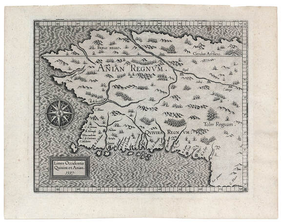
Limes Occidentis Quivira et Anian
Louvain 1597
Limes Occidentis Quivira et Anian
Louvain 1597
The area in this important map, from the first atlas devoted exclusively to America, is similar to that depicted earlier by Cornelis de Jode in Qvivirae Regnv of 1593 (previous map). However, this map extends southward only to the 30 degrees N latitude (San Francisco Bay is at 38 degrees N latitude).
The coastline above Cape Mendocino (correctly shown at about 40 degrees N latitude) may have been explored by Cabrillo in 1542-1544, but the place-names and topographical features are mostly imaginary. Nevertheless, this map and previous versions such as de Jode's map of Quivira anticipate the westward bulge of present-day Alaska.
Apart from the east-west distortion of the coastline, this map does display many of the coastal place-names, such as C. Mendocino, Sierra Nevada, C. de S. Francisco and, to the south, C. Blanco, more or less correctly. The Wytfliet map perpetuates the much-hoped-for prospect of a northwest passage and the separation of the continents by the Strait of Anian, which in this case is further highlighted by the use of Anian Regnvm (Kingdom of Anian) to designate present-day Alaska.
NEXT MAP
PREVIOUS MAP