Dudley
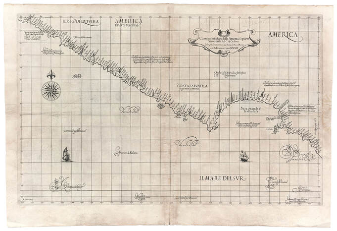
Carta particolare della America e parte maestrale dal C. di Cedros
Florence 1647
Carta particolare della America e parte maestrale dal C. di Cedros
Florence 1647
This large map details the West Coast from 27 degrees N along the coastline labeled Costa della California to 38 degrees N near present-day San Francisco. The place-names along the coast are derived from the voyages of Cabrillo, between 1542 and 1544, and Sebastian Vizcaino, in 1602. The Kingdom of Quivira, labeled Il Reg. di Quivira, is positioned in the upper left-hand corner. The legend to the left of center states that the details of the coast are not well known and that the distance from California to Cape Mendocino is six hundred leagues.
NEXT MAP
PREVIOUS MAP
NEXT MAP
PREVIOUS MAP


