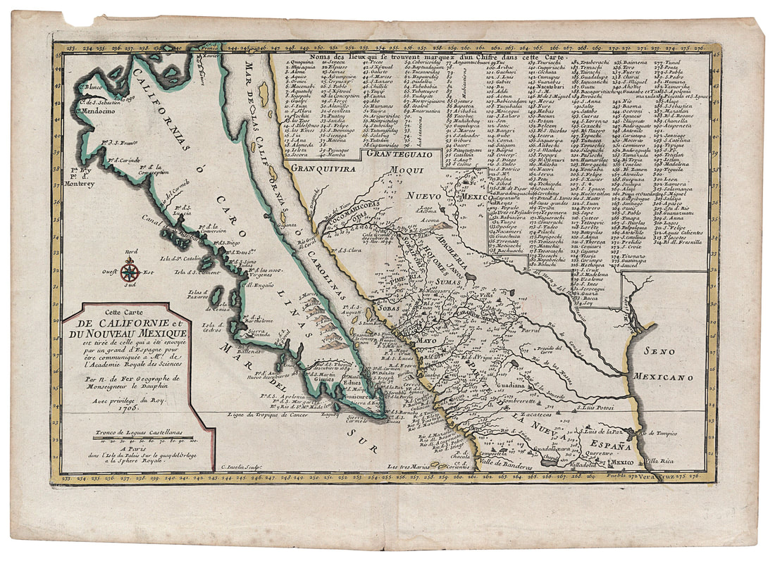
Nicolas de Fer
Carte De Californie et du Nouveau Mexique
Paris 1705
Carte De Californie et du Nouveau Mexique
Paris 1705
As a young man, Eusebio Kino chose to follow in the footsteps of his exemplar and idol, Francis Xavier, as a missionary to the Far East. He was ordained a Jesuit priest in 1677 at the age of thirty-two. But as fate would have it, he was sent to Mexico instead, arriving after much delay in 1681. Kino led many exploratory expeditions throughout northern Mexico, by his own count at least fifty, many of which led to the establishment of missions in what is now Sonora in northern Mexico and southern Arizona and New Mexico. In 1695 Kino published a map of the region showing all the established missions and towns and suggested that California was an island. This map was quickly plagiarized by Nicolas de Fer in Paris and published as his own in 1705. The de Fer map shows all 314 towns and missions appearing on Father Kino's original map and shows, as did Kino, California as an island with the same three-finger coastal outline at the north end that originated with Nicholas Sanson.
The business of supplying the missions on the Baja Peninsula by sea was expensive and laborious, and Kino resolved to determine for himself whether a land route was possible. Between 1698 and 1701, he made nine exploratory trips north and west. In 1698 he climbed the mountain he had named Santa Clara, which provided a panoramic view north to the Colorado River estuary. After several more trips to verify his observations, he officially reported to his superiors in 1701 that the Gulf of California (sometimes labeled Mar Vermejo or Red Sea) was closed and that California was a peninsula. A map accompanied his manuscript, and both reached Europe. The correction was first published in Paris in 1705 in Jesuit journals and quickly copied and recopied throughout Europe. However, many cartographers resisted the correction, most notably Herman Moll, a Dutch cartographer working in England, who as late as 1732 showed California as an island and stubbornly insisted that sailors who had circumnavigated California had visited his office in London. Eventually, in 1747, King Ferdinand VII of Spain issued a royal decree that California must no longer by considered an island.
NEXT MAP
PREVIOUS MAP


