Comte de La Perouse
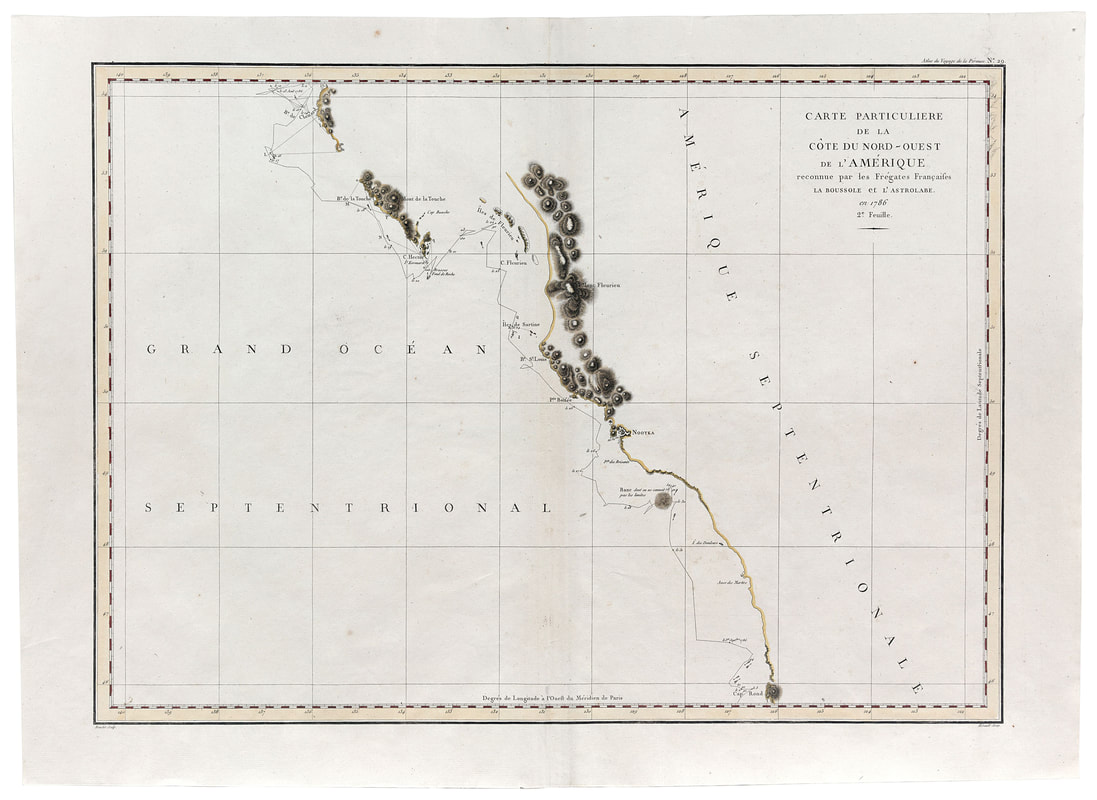
Carte Particuliere de la Cote Du Nord-Ouest de l'Amerique reconuue par les Fregates Francaises La Boussole et L'Astorbale en 1786
Paris 1797
Carte Particuliere de la Cote Du Nord-Ouest de l'Amerique reconuue par les Fregates Francaises La Boussole et L'Astorbale en 1786
Paris 1797
For much of the time (between 1768 and 1783) while Captain Cook was exploring the North Pacific, Britain and France were at war. Even in times of peace, the Anglo-French rivalry was strong. Wit the news of Cook's death in 1779 and the cessation of hostilities in 1783, the French government resolved to mount a competing expedition to the "Great Ocean" (the Pacific Ocean) to "complete various discoveries" and engage in "astronomical observations" and research into physics and natural history. (16) The man entrusted wit this mission was Jean-Francois de Galaup, comte de La Perouse, an experience captain in the French navy. He was placed in command of two fine frigates, La Boussole and L'Astrolabe.
La Perouse sailed west from Brest in August 1785 and on 24 June 1786 made landfall off the coast of present-day southeast Alaska, just below 60 degrees N latitude and within view of Mount Saint Elias. Fort the next three months he sailed south along the coast, eventually reaching Monterey. These two maps, printed in Paris in 1797 as part of a general atlas of the La Perouse expedition, show the meticulously charted coastline surveyed by the crews of La Boussole and L'Astrolabe. In contrast to the imaginative speculations of many earlier explorers and cartographers, the areas not explored are left blank by La Perouse, but he did substitute his own names for many - but not all - of those endowed by Captain Cook. Mount Elias, Cross Sound and Nootka are shown on the La Perouse maps but, for example, Cape St. James at the southern tip of Moresby Island in the Queen Charlotte Islands just south of 50 degrees N latitude is renamed Cape Hector and Mount Edgecombe (named by Captain Cook) near Sitka at 57 degrees N latitude is relabeled Mont Saint-Hyacinthe.
After leaving Monterey, La Perouse crossed the Pacific to Macao (near Hong Kong) and, in the summer of 1787, worked his way up the Asiatic coast of the Pacific. Encountering difficult and contrary winds as he approached the Bering Strait, he retreated to the Russian port of Petropavlovsk at the southern tip of the Kamchatka Peninsula. There he decided to send a report overland via Russia to Paris. He dispatched Jean, baron de Lesseps, on the eight thousand-mile trans-Siberian journey to France. (17) De Lesseps carried with him the reports, ships' logs, maps, and sketches made by the expedition to date.
This and the following map were derived from the dispatches carried by de Lesseps. As it turned out, he was the only member of the expedition to complete the circumnavigation; indeed the only member to survive. La Perouse and his companions left Petropavlovsk just before the ice set and sailed south. Calling at Samoa, the captain of L'Astrolabe and ten of his men were murdered. La Perouse sailed on, stopping at Tonga, Norfolk Island, and Port Jackson, the newly established British penal colony in New South Wales, Australia. They left Port Jackson in February 1788 and were never seen again. Thirty-eight years later the scattered remains of La Boussole and L'Astrolabe were discovered wrecked on a vicious reef on an atoll in the New Hebrides.
(16) C.P.C. Fleurieu, A Voyage Around the World 1790-1792 Performed by Etienne Marchand (London, 1801), lxix.
(17) Derek Wilson, The Circumnavigators (London: Constable, 1989), 192-94.